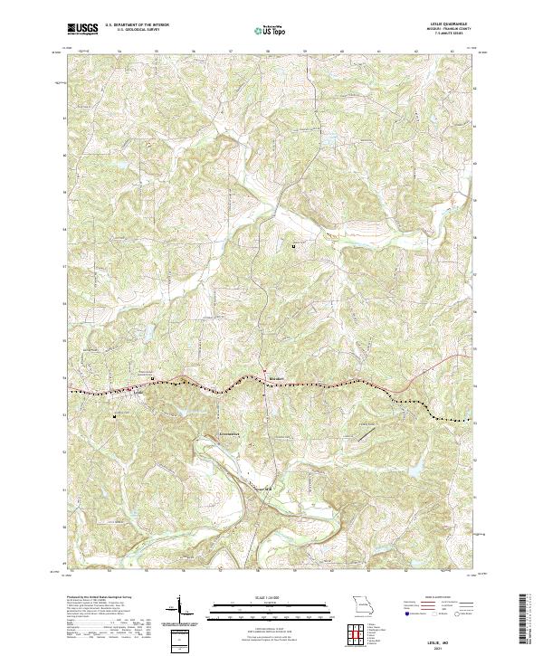
2021 Map of Leslie
USGS Topo · Published 2021About this map
The Bourbeuse River and its numerous tributaries, including Boehms Cr and Saint Johns Cr, shape the landscape of this Franklin County quadrangle. Small agricultural and residential clusters are centered around Leslie, Beaufort, and the rural crossing at Greenstreet. The presence of Noser Mill on a bend of the Bourbeuse River indicates the long-standing importance of water power and river access to the local economy. Genealogists will find significant value in the documentation of local burial sites, such as the Leslie United Methodist Cem, Woodman Cem, and the more isolated Butler Cem. The map reflects a blend of traditional land use and modern developments, with private aviation strips like Findley Field and recreation-oriented water bodies such as Flamingo Lakes and Mineral Lake dotting the countryside.
Find a feature on this map
79 named features on this map. Tap any name to fly to it.
Don’t see what you’re looking for? This feature index may not catch every label — zoom into the map to look around manually.
Map Details
Editions of this 2021 Leslie Map
This is the sole edition of this map. No revisions or reprints were ever made.
Other maps of this area

1890 · Hermann
USGS Topo · 1:125,000

1903 · Sullivan
USGS Topo · 1:125,000

1935 · Gerald
USGS Topo · 1:48,000

1936 · Hermann
USGS Topo · 1:48,000

1941 · Gerald
USGS Topo · 1:62,500

1942 · Hermann
USGS Topo · 1:62,500

1944 · Gerald
USGS Topo · 1:62,500

1945 · Hermann
USGS Topo · 1:62,500

1946 · Union
USGS Topo · 1:62,500

1948 · Union
USGS Topo · 1:62,500