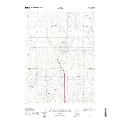
2019 Map of Leslie
USGS Topo · Published 2019About this map
The Grand River snakes through the southern portion of this landscape, carving a path near the crossroads of Berryville and Rives Junction. This area of southern Michigan is defined by its transition from organized grid-plan settlements like Leslie to a more dispersed rural network of family farms and cemeteries. Local history is deeply embedded in the land, with several burial sites such as Woodlawn Cem near the town center and East Rives Cem further south. The terrain is marked by distinctive elevations like Teaspoon Hill and drainage systems including Hunton Cr and the Royston Drain. The boundary between Ingham and Jackson counties runs along Baseline Rd, serving as a primary east-west axis that separates the township tiers. This record captures the contemporary layout of small-town Michigan, where established residential streets in Leslie meet the expansive agricultural and marshy lands surrounding Fox Lake and Mud Lake.
Find a feature on this map
56 named features on this map. Tap any name to fly to it.
Don’t see what you’re looking for? This feature index may not catch every label — zoom into the map to look around manually.
Map Details
Editions of this 2019 Leslie Map
This is the sole edition of this map. No revisions or reprints were ever made.
Other maps of this area

1909 · Mason
USGS Topo · 1:62,500

1910 · Lansing
USGS Topo · 1:62,500

1911 · Mason
USGS Topo · 1:62,500

1912 · Lansing
USGS Topo · 1:62,500

1919 · Springport
USGS Topo · 1:62,500

1919 · Rives Junction
USGS Topo · 1:62,500

1921 · Rives Junction
USGS Topo · 1:62,500

1921 · Springport
USGS Topo · 1:62,500

1958 · Grand Rapids
USGS Topo · 1:250,000

1961 · Grand Rapids
USGS Topo · 1:250,000