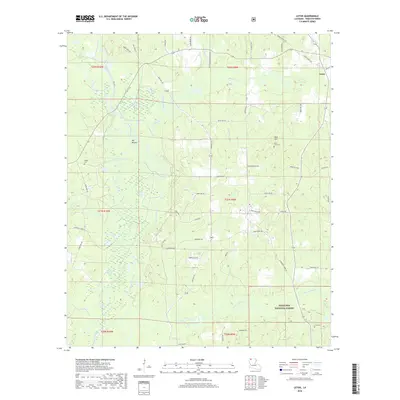
2018 Map of Leton
USGS Topo · Published 2018About this map
Bayou Dorcheat anchors the drainage of this north Louisiana landscape, carving a low-lying basin characterized by features like Wildcat Slough and Big Slough. The higher ground is defined by notable elevations such as Big Mound and Bull Hill, which provide relief in a region otherwise dominated by the dense woodlands of the Kisatchie National Forest. This 2018 survey reveals a rural network of roads and family-named landmarks, such as Hodge Cem and Saint Luke Cem, which are essential markers for genealogists tracing roots in the settlement of Leton. The map illustrates the persistent intersection of timberland and agriculture, where parish roads like Parish Rd 256 connect isolated homesteads and community landmarks. The southern reaches of the quadrangle are further shaped by the winding paths of Flat Lick Bayou and Fiddler Cr, reflecting the intricate hydrology of Webster Parish.
Find a feature on this map
65 named features on this map. Tap any name to fly to it.
Don’t see what you’re looking for? This feature index may not catch every label — zoom into the map to look around manually.
Map Details
Editions of this 2018 Leton Map
This is the sole edition of this map. No revisions or reprints were ever made.
Other maps of this area

1922 · Sarepta
USGS Topo · 1:62,500

1924 · Sarepta
USGS Topo · 1:62,500

1947 · Minden
USGS Topo · 1:62,500

1949 · Minden
USGS Topo · 1:62,500

1949 · Gibsland
USGS Topo · 1:62,500

1950 · Gibsland
USGS Topo · 1:62,500

1952 · Homer
USGS Topo · 1:62,500

1955 · Shreveport
USGS Topo · 1:250,000

1956 · Shreveport
USGS Topo · 1:250,000

1956 · Sarepta
USGS Topo · 1:62,500