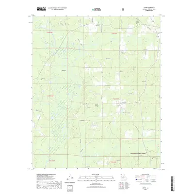
2020 Map of Leton
USGS Topo · Published 2020About this map
Bayou Dorcheat dominates the western half of this Webster Parish landscape, its winding course accompanied by a network of drainage features like Wildcat Slough, Big Slough, and Davis Slough. The terrain is defined by low-lying wetlands and notable rises such as Big Mound and Bull Hill. This area is rich in genealogical interest, with numerous small burial sites scattered across the township lines, including the Sikes Family Cem, Phillips-Wallace Cem, and Reagan-Kea Cem.
Find a feature on this map
70 named features on this map. Tap any name to fly to it.
Don’t see what you’re looking for? This feature index may not catch every label — zoom into the map to look around manually.
Map Details
Editions of this 2020 Leton Map
This is the sole edition of this map. No revisions or reprints were ever made.
Other maps of this area

1922 · Sarepta
USGS Topo · 1:62,500

1924 · Sarepta
USGS Topo · 1:62,500

1947 · Minden
USGS Topo · 1:62,500

1949 · Minden
USGS Topo · 1:62,500

1949 · Gibsland
USGS Topo · 1:62,500

1950 · Gibsland
USGS Topo · 1:62,500

1952 · Homer
USGS Topo · 1:62,500

1955 · Shreveport
USGS Topo · 1:250,000

1956 · Shreveport
USGS Topo · 1:250,000

1956 · Sarepta
USGS Topo · 1:62,500