2024 Map of Leton
USGS Topo · Published 2024About this map
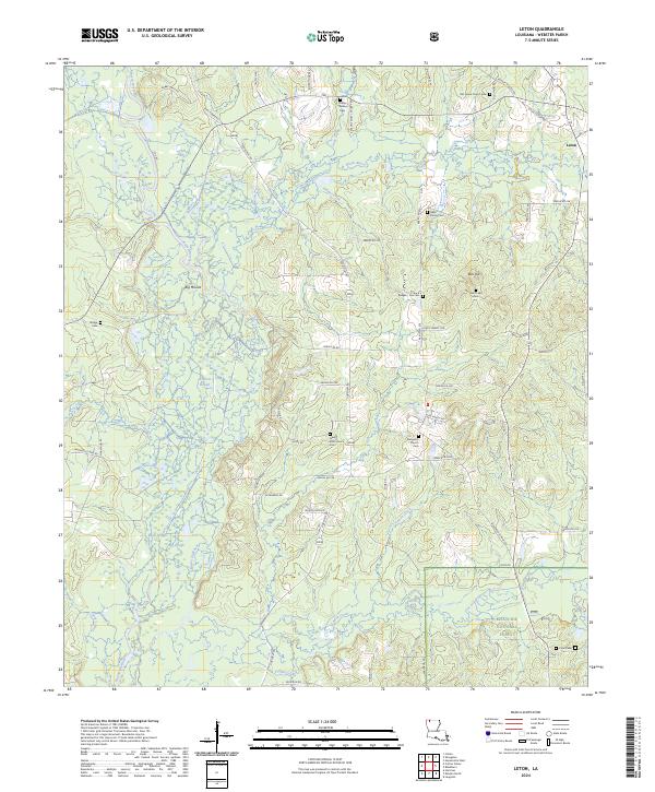
Bayou Dorcheat and its various sloughs and tributaries, including Wildcat Slough and Big Slough, define the western corridor of this parish landscape. The small settlement of Leton sits in the northeast corner, serving as a focal point for a rural network of roads like Rodney Martin Rd and Leton Cutoff Rd. Genealogists will find a high concentration of burial sites throughout the area, from the Sikes Family Cem and Phillips Wallace Cem to those affiliated with local congregations such as Evergreen Church Cem and New Zion Church Cem. To the southeast, the terrain transitions into the protected woods of the Kisatchie National Forest, while the northern reaches are marked by prominent elevations like Bull Hill and Big Mound.
Find a feature on this map
68 named features on this map. Tap any name to fly to it.
Don’t see what you’re looking for? This feature index may not catch every label — zoom into the map to look around manually.
Map Details
Editions of this 2024 Leton Map
This is the sole edition of this map. No revisions or reprints were ever made.
Other maps of this area

1922 · Sarepta
USGS Topo · 1:62,500

1924 · Sarepta
USGS Topo · 1:62,500

1947 · Minden
USGS Topo · 1:62,500

1949 · Minden
USGS Topo · 1:62,500

1949 · Gibsland
USGS Topo · 1:62,500

1950 · Gibsland
USGS Topo · 1:62,500

1952 · Homer
USGS Topo · 1:62,500

1955 · Shreveport
USGS Topo · 1:250,000

1956 · Shreveport
USGS Topo · 1:250,000

1956 · Sarepta
USGS Topo · 1:62,500