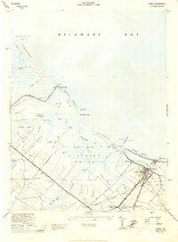
1944 Map of Lewes
USGS Topo · Published 1944About this map
The town of Lewes and its coastal surroundings are documented here during the mid-1940s, showing a landscape defined by intricate waterways and tidal marshes. The recently completed Lewes and Rehoboth Canal cuts through the terrain, connecting with the Roosevelt Inlet to provide vital maritime access. Historical settlements like Pilottown, Quakertown, and Nassau dot the inland landscape, while the coastal edge is marked by features like Primehook Beach and Broadkill Beach. Inland, the agricultural and social fabric of Sussex County is visible through Whites Chapel and Burtons Chapel. Transport relies on the rail lines of the Delmarva Division and the Georgetown Lewes Road, which connect these small crossroads communities. Notable family-named landings such as Black Hog Ldg and Hazzard Ldg hint at the local river-based economy of the era.
Find a feature on this map
82 named features on this map. Tap any name to fly to it.
Don’t see what you’re looking for? This feature index may not catch every label — zoom into the map to look around manually.
Map Details
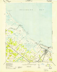
Editions of this 1944 Lewes Map
2 editions found
Other maps of this area

1917 · Millsboro
USGS Topo · 1:62,500

1918 · Cedar Creek
USGS Topo · 1:62,500

1918 · Rehoboth
USGS Topo · 1:62,500

1918 · Cape Henlopen
USGS Topo · 1:62,500

1919 · Cedar Creek
USGS Topo · 1:62,500

1937 · Cape Henlopen
USGS Topo · 1:62,500

1938 · Cedar Creek
USGS Topo · 1:62,500

1938 · Millsboro
USGS Topo · 1:62,500

1938 · Rehoboth
USGS Topo · 1:62,500

1943 · Fairmount
USGS Topo · 1:24,000