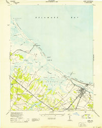
1944 Map of Lewes
USGS Topo · Published 1944About this map
The maritime gateway of Lewes and the surrounding coastal marshlands of Sussex County are captured here just after the mid-century, based on 1943 air photographs and field work. This coastal landscape is defined by its strategic water access, from the Lewes and Rehoboth Canal to the Roosevelt Inlet, marked by several navigational aids including the North Jetty Lt and Rear Range Lt. The map reveals a transition from the structured grid of the town center to the sprawling inland necks, such as Covington Neck and Hells Neck, where small communities like Nassau and Quakertown were established near the Pennsylvania railroad line.
Find a feature on this map
54 named features on this map. Tap any name to fly to it.
Don’t see what you’re looking for? This feature index may not catch every label — zoom into the map to look around manually.
Map Details
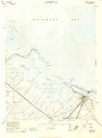
Editions of this 1944 Lewes Map
2 editions found
Other maps of this area

1917 · Millsboro
USGS Topo · 1:62,500

1918 · Cedar Creek
USGS Topo · 1:62,500

1918 · Rehoboth
USGS Topo · 1:62,500

1918 · Cape Henlopen
USGS Topo · 1:62,500

1919 · Cedar Creek
USGS Topo · 1:62,500

1937 · Cape Henlopen
USGS Topo · 1:62,500

1938 · Cedar Creek
USGS Topo · 1:62,500

1938 · Millsboro
USGS Topo · 1:62,500

1938 · Rehoboth
USGS Topo · 1:62,500

1943 · Fairmount
USGS Topo · 1:24,000