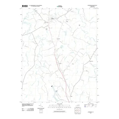
2010 Map of Lewisburg
USGS Topo · Published 2010About this map
Lewisburg serves as the central hub of this 2010 Logan County survey, where US Hwy 431 bisects a landscape defined by the winding course of the Mud River and its numerous tributaries. The map documents a cluster of rural Kentucky settlements including Epleys, Jerico, and the evocatively named Lost City. For family historians, the sheet provides exact locations for several community burial grounds, such as Kennerlys Chapel Cemetery and Mount Pleasant Cemetery. The western portion of the quadrangle is dominated by the complex drainage of Elk Lick Creek, while the south-central region features the recreational and terrain markers of Wildcat Hollow and Camp Wildcat Hollow. The intersection of modern infrastructure and older land divisions is evident in the transition from the main highway to local family-named routes like Forgy Rd and R L Stuart Rd.
Find a feature on this map
61 named features on this map. Tap any name to fly to it.
Don’t see what you’re looking for? This feature index may not catch every label — zoom into the map to look around manually.
Map Details
Editions of this 2010 Lewisburg Map
This is the sole edition of this map. No revisions or reprints were ever made.
Other maps of this area

1911 · Drakesboro
USGS Topo · 1:48,000

1911 · Dunmor
USGS Topo · 1:48,000

1913 · Drakesboro
USGS Topo · 1:62,500

1914 · Dunmor
USGS Topo · 1:62,500

1950 · Olmstead
USGS Topo · 1:24,000

1951 · Olmstead
USGS Topo · 1:24,000

1951 · Lewisburg
USGS Topo · 1:24,000

1951 · Homer
USGS Topo · 1:24,000

1952 · Russellville
USGS Topo · 1:24,000

1952 · Sharon Grove
USGS Topo · 1:24,000