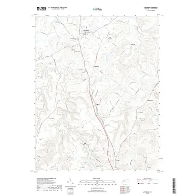
2019 Map of Lewisburg
USGS Topo · Published 2019About this map
Lewisburg serves as the central hub of this Logan County landscape, where the intersection of N Main St and Stacker St anchors the local street grid. The terrain is defined by a dense network of hydrologic features, including the winding Mud River to the east and the convergence of Wolf Lick Creek and Elk Lick Creek in the north. This survey provides significant genealogical value through its documentation of rural burial sites, such as Kennerlys Chapel Cem, Epleys Cem, and the Head Cem located near Cooperstown. To the south, Wildcat Hollow and Danby reflect the more dispersed settlement patterns of the region, while the curiously named Lost City sits tucked between Austin Cr and McAdoo Cr. The map preserves the complex of named roads that connect these small communities, including the Old Jericho-Lewisburg Rd and Stuart Chapel Rd.
Find a feature on this map
90 named features on this map. Tap any name to fly to it.
Don’t see what you’re looking for? This feature index may not catch every label — zoom into the map to look around manually.
Map Details
Editions of this 2019 Lewisburg Map
This is the sole edition of this map. No revisions or reprints were ever made.
Other maps of this area

1911 · Drakesboro
USGS Topo · 1:48,000

1911 · Dunmor
USGS Topo · 1:48,000

1913 · Drakesboro
USGS Topo · 1:62,500

1914 · Dunmor
USGS Topo · 1:62,500

1950 · Olmstead
USGS Topo · 1:24,000

1951 · Olmstead
USGS Topo · 1:24,000

1951 · Lewisburg
USGS Topo · 1:24,000

1951 · Homer
USGS Topo · 1:24,000

1952 · Russellville
USGS Topo · 1:24,000

1952 · Sharon Grove
USGS Topo · 1:24,000