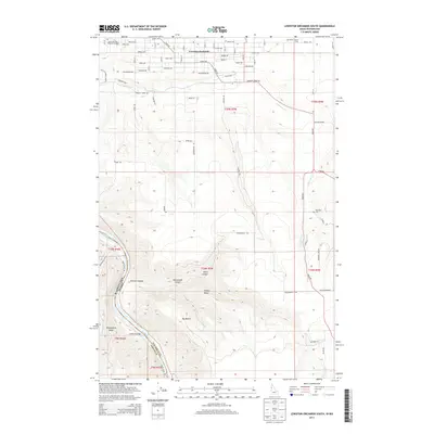
2013 Map of Lewiston Orchards South
USGS Topo · Published 2013About this map
Lewiston Orchards serves as the primary residential hub in this corner of Nez Perce County, situated where the high plateau begins its dramatic descent toward the water. The landscape is defined by the sharp transition from the structured residential grid of the north—featuring landmarks like the Lewis and Clark Memorial Gardens—to the deep, carved drainages of the south. The Snake River cuts through the southwest corner, forming the state boundary between Washington and Idaho and creating distinct riverfront features like Ackerman Bar.
Find a feature on this map
53 named features on this map. Tap any name to fly to it.
Don’t see what you’re looking for? This feature index may not catch every label — zoom into the map to look around manually.
Map Details
Editions of this 2013 Lewiston Orchards South Map
This is the sole edition of this map. No revisions or reprints were ever made.
Other maps of this area

1944 · Anatone
USGS Topo · 1:62,500

1945 · Clarkston
USGS Topo · 1:62,500

1946 · Limekiln Rapids
USGS Topo · 1:62,500

1946 · Anatone
USGS Topo · 1:62,500

1948 · Clarkston
USGS Topo · 1:62,500

1955 · Pullman
USGS Topo · 1:250,000

1958 · Pullman
USGS Topo · 1:250,000

1958 · Lapwai
USGS Topo · 1:24,000

1958 · Sweetwater
USGS Topo · 1:24,000

1958 · Lewiston Orchards North
USGS Topo · 1:24,000