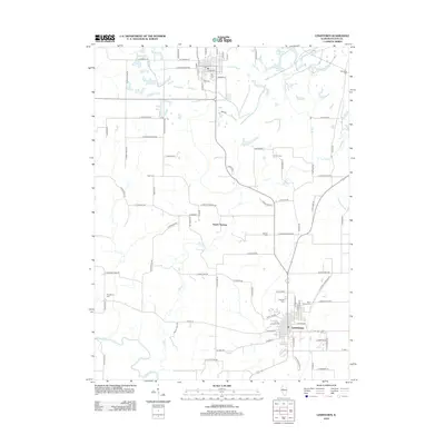
2012 Map of Lewistown
USGS Topo · Published 2012About this map
Lewistown serves as the primary hub of this Fulton County region, where a dense grid of streets like W Milton Ave and E Euclid Ave meets the surrounding agricultural landscape. The township is characterized by numerous family and community burial grounds, including Oak Hill Cem and Saint Marys Cem near the town center, while more remote sites like Providence Cem and Engle Cem dot the rural outskirts. The western boundary is defined by the winding course of the Spoon River, which carves through the terrain south of Depler Springs. Waterways such as Big Cr, Slug Run, and Laswell Br create a network of drainage across the prairie, punctuated by smaller bodies of water like Road Fill Lake. This map captures a mature landscape of named country roads and established rural settlements, preserving the exact locations of local landmarks from the Post Office to outlying farmsteads.
Find a feature on this map
93 named features on this map. Tap any name to fly to it.
Don’t see what you’re looking for? This feature index may not catch every label — zoom into the map to look around manually.
Map Details
Editions of this 2012 Lewistown Map
This is the sole edition of this map. No revisions or reprints were ever made.
Other maps of this area

1912 · Canton
USGS Topo · 1:62,500

1915 · Avon
USGS Topo · 1:62,500

1918 · Vermont
USGS Topo · 1:62,500

1921 · Vermont
USGS Topo · 1:62,500

1925 · Havana
USGS Topo · 1:62,500

1944 · Avon
USGS Topo · 1:62,500

1947 · Lewistown
USGS Topo · 1:24,000

1947 · St. David
USGS Topo · 1:24,000

1947 · Havana
USGS Topo · 1:24,000

1948 · Duncan Mills
USGS Topo · 1:24,000