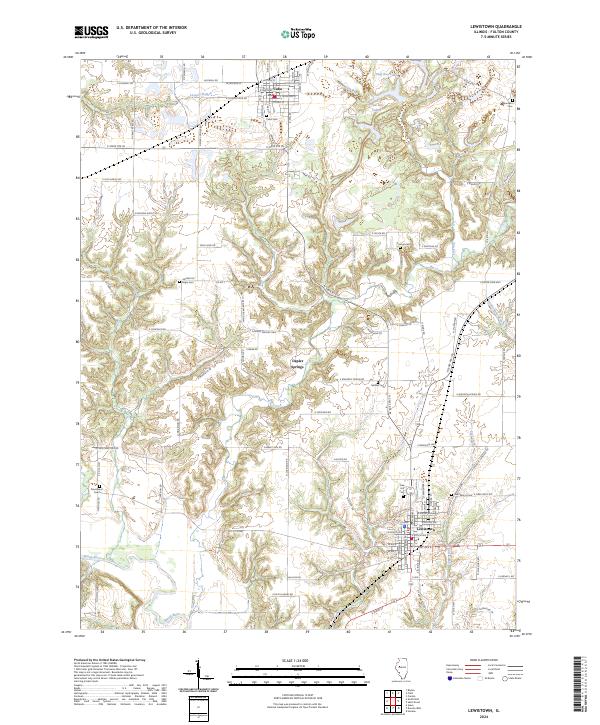
2024 Map of Lewistown
USGS Topo · Published 2024About this map
The Spoon River valley dominates the southwestern corner of this West-Central Illinois landscape, which transitions from the northern town of Cuba to the county seat at Lewistown. The terrain is defined by a dendritic network of drainages including Slug Run, Big Creek, and East Creek, each carving through the agricultural uplands. Settlement patterns are largely dictated by the intersection of N State Rte 97 and N State Rte 100, which meet in Lewistown. For genealogists, the map is remarkably dense with burial sites, preserving the locations of rural family and community grounds like McNeil Cem, Saunders Cem, and Providence Cem. Smaller locales like Depler Springs and distinctive roadway names such as E Fiber Optic Rd and E Christmas Tree Rd illustrate the area's mix of traditional farming roots and modern utility infrastructure.
Find a feature on this map
57 named features on this map. Tap any name to fly to it.
Don’t see what you’re looking for? This feature index may not catch every label — zoom into the map to look around manually.
Map Details
Editions of this 2024 Lewistown Map
This is the sole edition of this map. No revisions or reprints were ever made.
Other maps of this area

1912 · Canton
USGS Topo · 1:62,500

1915 · Avon
USGS Topo · 1:62,500

1918 · Vermont
USGS Topo · 1:62,500

1921 · Vermont
USGS Topo · 1:62,500

1925 · Havana
USGS Topo · 1:62,500

1944 · Avon
USGS Topo · 1:62,500

1947 · Lewistown
USGS Topo · 1:24,000

1947 · St. David
USGS Topo · 1:24,000

1947 · Havana
USGS Topo · 1:24,000

1948 · Duncan Mills
USGS Topo · 1:24,000