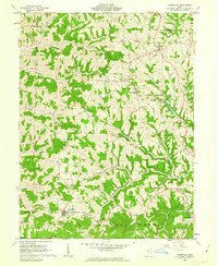
1961 Map of Lewisville
USGS Topo · Published 1963About this map
Oil and gas development defines the 1961 landscape of the Ohio hills, evidenced by numerous Oil Wells and a complex network of Pipelines stretching across the terrain. Small rural settlements like Miltonsburg and Malaga serve as local hubs, while Lewisville anchors the southern portion of the sheet near the edge of the Wayne National Forest. The map is particularly rich for genealogical research, documenting numerous small family and community burial sites such as the Free Burial Ground, German Cem, and Sloan Cem.
Find a feature on this map
53 named features on this map. Tap any name to fly to it.
Don’t see what you’re looking for? This feature index may not catch every label — zoom into the map to look around manually.
Map Details
Editions of this 1961 Lewisville Map
2 editions found
Other maps of this area

1903 · Macksburg
USGS Topo · 1:62,500

1905 · New Matamoras
USGS Topo · 1:62,500

1905 · Woodsfield
USGS Topo · 1:62,500

1905 · Macksburg
USGS Topo · 1:62,500

1909 · Summerfield
USGS Topo · 1:62,500

1911 · Summerfield
USGS Topo · 1:62,500

1924 · New Matamoras
USGS Topo · 1:62,500

1926 · New Matamoras
USGS Topo · 1:62,500

1949 · Clarksburg
USGS Topo · 1:250,000

1956 · Clarksburg
USGS Topo · 1:250,000