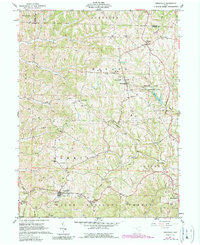
1961 Map of Lewisville
USGS Topo · Published 1990About this map
The Wayne National Forest and the Monroe Lake State Wildlife Area dominate the southeast and central portions of this landscape, reflecting a region defined by conservation and resource extraction. The map reveals an intensive network of Oil Wells and pipelines scattered across the hills, particularly around Monroefield and south toward Lewisville. This industrial activity shares the land with older cultural footprints, including numerous family and church burial sites such as the Free Burial Ground and Eggar Cem.
Find a feature on this map
51 named features on this map. Tap any name to fly to it.
Don’t see what you’re looking for? This feature index may not catch every label — zoom into the map to look around manually.
Map Details
Editions of this 1961 Lewisville Map
2 editions found
Other maps of this area

1903 · Macksburg
USGS Topo · 1:62,500

1905 · New Matamoras
USGS Topo · 1:62,500

1905 · Woodsfield
USGS Topo · 1:62,500

1905 · Macksburg
USGS Topo · 1:62,500

1909 · Summerfield
USGS Topo · 1:62,500

1911 · Summerfield
USGS Topo · 1:62,500

1924 · New Matamoras
USGS Topo · 1:62,500

1926 · New Matamoras
USGS Topo · 1:62,500

1949 · Clarksburg
USGS Topo · 1:250,000

1956 · Clarksburg
USGS Topo · 1:250,000