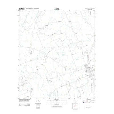
2012 Map of Lexington
USGS Topo · Published 2012About this map
Lexington serves as the central hub of this Lee County landscape, where the town grid is defined by streets like N Rockdale St and Caldwell Rd. The surrounding countryside is a network of small watercourses and family-named landmarks, revealing a history of rural settlement and agriculture. Numerous burial grounds are scattered throughout the area, including the German Cem, Germania Cem, and Mundine Cem, providing valuable touchpoints for genealogical research. The terrain is marked by distinctive features such as Grapevine Gully and the twin basins of Caraway Lake Number 1 and Caraway Lake Number 2. Water defines the local geography, with Middle Yegua Cr and its tributaries like Coupland Br and Two Mile Br winding through the parcels. Transportation in this era relied on a mix of farm-to-market roads and private lanes, while the Cotton Patch Airport highlights the presence of local aviation infrastructure serving the community.
Find a feature on this map
96 named features on this map. Tap any name to fly to it.
Don’t see what you’re looking for? This feature index may not catch every label — zoom into the map to look around manually.
Map Details
Editions of this 2012 Lexington Map
This is the sole edition of this map. No revisions or reprints were ever made.
Other maps of this area

1885 · Taylor
USGS Topo · 1:125,000

1885 · Bastrop
USGS Topo · 1:125,000

1887 · Taylor
USGS Topo · 1:125,000

1893 · Bastrop
USGS Topo · 1:125,000

1894 · Taylor
USGS Topo · 1:125,000

1904 · Bastrop
USGS Topo · 1:125,000

1919 · Dime Box
USGS Topo · 1:62,500

1948 · Lexington
USGS Topo · 1:62,500

1950 · Lexington
USGS Topo · 1:62,500

1954 · Austin
USGS Topo · 1:250,000