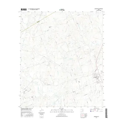
2016 Map of Lexington
USGS Topo · Published 2016About this map
The town of Lexington serves as the focal point for this area of Lee County, showing a detailed network of local roads and community landmarks. Several burial grounds are dispersed across the surrounding countryside, including Mundine Cem to the north and the Germania Cem and German Cem located further east and south. This concentration of cemeteries provides a clear view into the historical settlement patterns of the region, where family and community plots were established along the various creek branches.
Find a feature on this map
81 named features on this map. Tap any name to fly to it.
Don’t see what you’re looking for? This feature index may not catch every label — zoom into the map to look around manually.
Map Details
Editions of this 2016 Lexington Map
This is the sole edition of this map. No revisions or reprints were ever made.
Other maps of this area

1885 · Taylor
USGS Topo · 1:125,000

1885 · Bastrop
USGS Topo · 1:125,000

1887 · Taylor
USGS Topo · 1:125,000

1893 · Bastrop
USGS Topo · 1:125,000

1894 · Taylor
USGS Topo · 1:125,000

1904 · Bastrop
USGS Topo · 1:125,000

1919 · Dime Box
USGS Topo · 1:62,500

1948 · Lexington
USGS Topo · 1:62,500

1950 · Lexington
USGS Topo · 1:62,500

1954 · Austin
USGS Topo · 1:250,000