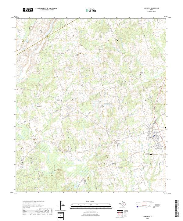
2022 Map of Lexington
USGS Topo · Published 2022About this map
The town of Lexington serves as the focal point for this section of Lee County, where the intersection of Farm to Market roads and local routes like Walch Ln and Rockdale St define the local geography. The landscape is characterized by a high density of rural burial grounds, including Lexington Cem, Lexington Memorial Cem, and the Saint James Lutheran Cem, which offer significant value for genealogical research in this part of Texas. Outside the primary settlement, the terrain is marked by the winding path of Middle Yegua Cr and its numerous tributaries such as Coupland Br and Two Mile Br. Small private aviation facilities like Cotton Patch Airport and water features like Caraway Lake Number 1 reflect the modern land use patterns in this predominantly agricultural region near the Milam and Lee county line.
Find a feature on this map
90 named features on this map. Tap any name to fly to it.
Don’t see what you’re looking for? This feature index may not catch every label — zoom into the map to look around manually.
Map Details
Editions of this 2022 Lexington Map
This is the sole edition of this map. No revisions or reprints were ever made.
Other maps of this area

1885 · Taylor
USGS Topo · 1:125,000

1885 · Bastrop
USGS Topo · 1:125,000

1887 · Taylor
USGS Topo · 1:125,000

1893 · Bastrop
USGS Topo · 1:125,000

1894 · Taylor
USGS Topo · 1:125,000

1904 · Bastrop
USGS Topo · 1:125,000

1919 · Dime Box
USGS Topo · 1:62,500

1948 · Lexington
USGS Topo · 1:62,500

1950 · Lexington
USGS Topo · 1:62,500

1954 · Austin
USGS Topo · 1:250,000