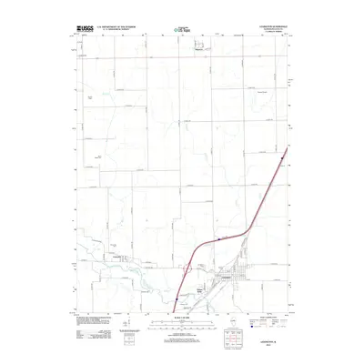
2012 Map of Lexington
USGS Topo · Published 2012About this map
The Mackinaw River meanders across this McLean County landscape, providing the primary drainage for the agricultural lands surrounding Lexington. This survey illustrates the spatial relationship between the town center and outlying developments like Timber Ridge, while the gridded road network, including the P J Keller Hwy and Clarksville Rd, defines the movement of local commerce. Genealogists will find a concentration of local history at Hibbs Bigger Cem, Scrogin Cem, and the Clarksville Cem, each marking the legacy of early families in the region.
Find a feature on this map
81 named features on this map. Tap any name to fly to it.
Don’t see what you’re looking for? This feature index may not catch every label — zoom into the map to look around manually.
Map Details
Editions of this 2012 Lexington Map
This is the sole edition of this map. No revisions or reprints were ever made.
Other maps of this area

1926 · Normal
USGS Topo · 1:62,500

1930 · Normal
USGS Topo · 1:62,500

1935 · Pontiac
USGS Topo · 1:62,500

1939 · Pontiac
USGS Topo · 1:62,500

1957 · Colfax
USGS Topo · 1:62,500

1958 · Flanagan
USGS Topo · 1:62,500

1958 · Peoria
USGS Topo · 1:250,000

1961 · Peoria
USGS Topo · 1:250,000

1963 · Peoria
USGS Topo · 1:250,000

1981 · Lexington
USGS Topo · 1:24,000