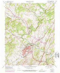
1967 Map of Lexington
USGS Topo · Published 1989About this map
Lexington serves as the academic and civic hub of Rockbridge County, anchored by the expansive campuses of Washington & Lee University and the Virginia Military Institute. The town's layout reflects its historical development along the Maury River, where the Chesapeake and Ohio railroad corridor transitions into the local industry and services of East Lexington. Beyond the urban core, the landscape is defined by its educational and religious institutions, including Central School, the Stonewall Jackson Hospital, and several rural sanctuaries such as New Monmouth Ch and Ebenezer Ch. Significant topographic features like Horseshoe Bend and Lovers Leap overlook the river valley, while an Old Railroad Grade and the Old Monmouth Cem provide clues to earlier transit and settlement patterns. The map highlights the town's evolution, showing the core city limits and the neighboring community of Newtown.
Find a feature on this map
56 named features on this map. Tap any name to fly to it.
Don’t see what you’re looking for? This feature index may not catch every label — zoom into the map to look around manually.
Map Details
Editions of this 1967 Lexington Map
4 editions found
Other maps of this area

1894 · Natural Bridge
USGS Topo · 1:125,000

1894 · Lexington
USGS Topo · 1:125,000

1894 · Natural Bridge
USGS Topo · 1:62,500

1907 · Natural Bridge Special
USGS Topo · 1:62,500

1932 · Lexington
USGS Topo · 1:48,000

1935 · Buena Vista
USGS Topo · 1:48,000

1937 · Lexington
USGS Topo · 1:62,500

1939 · Buena Vista
USGS Topo · 1:62,500

1940 · Buena Vista
USGS Topo · 1:62,500

1946 · Millboro
USGS Topo · 1:62,500