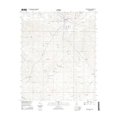
2015 Map of Lexington South
USGS Topo · Published 2015About this map
Lexington serves as the focal point for this section of Holmes County, situated at the intersection of various historic travel routes including Old Tchula Rd and Old Wire Rd. The landscape is characterized by a high density of small, family or community-oriented burial sites such as Stigler Cem and Odd Fellows Cem, which offer significant value for genealogical research in this rural corridor. A network of meandering waterways, including Black Creek and Gourdvine Cr, carves through the terrain, influencing the placement of smaller settlements like Brozville and Franklin. The presence of the C. A. Moore Airport north of the primary township highlights the area's modern infrastructure development while rural life continues to center around established roads like Bowling Green Rd and Hebron Rd.
Find a feature on this map
85 named features on this map. Tap any name to fly to it.
Don’t see what you’re looking for? This feature index may not catch every label — zoom into the map to look around manually.
Map Details
Editions of this 2015 Lexington South Map
This is the sole edition of this map. No revisions or reprints were ever made.
Other maps of this area

1940 · Lexington
USGS Topo · 1:62,500

1953 · Meridian
USGS Topo · 1:250,000

1953 · Greenwood
USGS Topo · 1:250,000

1953 · West Point
USGS Topo · 1:250,000

1955 · Jackson
USGS Topo · 1:250,000

1956 · Greenwood
USGS Topo · 1:250,000

1957 · Meridian
USGS Topo · 1:250,000

1957 · Lexington
USGS Topo · 1:62,500

1958 · West Point
USGS Topo · 1:250,000

1958 · Lexington
USGS Topo · 1:62,500