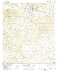
1982 Map of Lexington South
USGS Topo · Published 1982About this map
The city of Lexington serves as the focal point of this Holmes County landscape, situated where Black Creek meanders through the northern reaches. The area is dense with community landmarks from the late 1970s, including Central Holmes Academy and Saints College, alongside numerous rural spiritual centers like Sweetwater Ch and Epworth Ch. The transportation infrastructure is anchored by the Illinois Central Gulf railroad, which parallels the creek, and the C A Moore Airfield located to the northeast.
Find a feature on this map
37 named features on this map. Tap any name to fly to it.
Don’t see what you’re looking for? This feature index may not catch every label — zoom into the map to look around manually.
Map Details
Editions of this 1982 Lexington South Map
This is the sole edition of this map. No revisions or reprints were ever made.
Other maps of this area

1940 · Lexington
USGS Topo · 1:62,500

1953 · Meridian
USGS Topo · 1:250,000

1953 · Greenwood
USGS Topo · 1:250,000

1953 · West Point
USGS Topo · 1:250,000

1955 · Jackson
USGS Topo · 1:250,000

1956 · Greenwood
USGS Topo · 1:250,000

1957 · Meridian
USGS Topo · 1:250,000

1957 · Lexington
USGS Topo · 1:62,500

1958 · West Point
USGS Topo · 1:250,000

1958 · Lexington
USGS Topo · 1:62,500