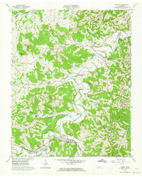
1962 Map of Liberty
USGS Topo · Published 1964About this map
Smith Fork dictates the settlement pattern of this Tennessee landscape, winding through a series of narrow valleys where small communities like Liberty and Dowelltown are concentrated. In the early 1960s, these rural enclaves remained deeply rooted in a network of family-named landmarks and local institutions. The map reveals an exceptionally high density of small burial grounds and rural houses of worship, such as Malone Chapel, New Hope Ch, and Fuller Chapel, which speak to the area's genealogical depth.
Find a feature on this map
63 named features on this map. Tap any name to fly to it.
Don’t see what you’re looking for? This feature index may not catch every label — zoom into the map to look around manually.
Map Details
Editions of this 1962 Liberty Map
3 editions found
Other maps of this area

1893 · Mc Minnville
USGS Topo · 1:125,000

1895 · Mc Minnville
USGS Topo · 1:125,000

1908 · Woodbury
USGS Topo · 1:62,500

1928 · Gordonsville
USGS Topo · 1:62,500

1942 · Statesville
USGS Topo · 1:100,000

1953 · Chattanooga
USGS Topo · 1:250,000

1956 · Columbia
USGS Topo · 1:250,000

1956 · Corbin
USGS Topo · 1:250,000

1956 · Nashville
USGS Topo · 1:250,000

1957 · Chattanooga
USGS Topo · 1:250,000