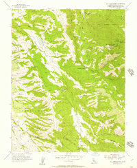
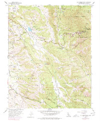
1955 Map of Lick Observatory
USGS Topo · Published 1957About this map
Mt Hamilton and the high ridges of the Diablo Range dominate this mid-century landscape, centered on the Lick Observatory. The summit area is a dense cluster of scientific infrastructure, including the 120 inch Telescope, Crossley Reflector, and the Photographic Telescope. Beyond the observatory grounds, the terrain drops into Halls Valley and the deep canyons of San Felipe Creek and Isabel Creek. Evidence of earlier rural life and resource management is found in the Highland Sch (Abandoned) and the Smith Creek Ranger Sta, while the western edge reaches into the Pueblo Lands of San Jose. The map details a network of rugged access points like Quimby Road and several unnamed jeep trails connecting remote peaks like Copernicus Peak and Mt Misery.
Find a feature on this map
60 named features on this map. Tap any name to fly to it.
Don’t see what you’re looking for? This feature index may not catch every label — zoom into the map to look around manually.
Map Details
Editions of this 1955 Lick Observatory Map
5 editions found
Other maps of this area

1889 · San Jose
USGS Topo · 1:62,500

1897 · San Jose
USGS Topo · 1:62,500

1897 · Mt. Hamilton
USGS Topo · 1:62,500

1899 · San Jose
USGS Topo · 1:62,500

1916 · New Almaden
USGS Topo · 1:48,000

1917 · Morgan Hill
USGS Topo · 1:62,500

1919 · New Almaden
USGS Topo · 1:62,500

1939 · Morgan Hill
USGS Topo · 1:62,500

1940 · Los Gatos
USGS Topo · 1:62,500

1941 · Morgan Hill
USGS Topo · 1:62,500