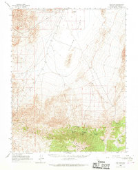
1963 Map of Lida Wash
USGS Topo · Published 1969About this map
Clayton Valley dominates the northern landscape of this Esmeralda County region, characterized by its expansive salt flats and prominent Sand Dunes. The southern portion of the map transitions into higher elevations where the Silver Peak Range and the Palmetto Mts converge. This arid environment is punctuated by vital water sources such as Horath Corral Spring, Birch Creek Spring, and Pocahontas Spring, which supported the early pastoral and mining activities in the area. Evidence of resource extraction is visible through the McNamara Mine and other unnamed mine sites located near the southern mountains. The drainage of Lida Wash cuts through the rugged topography, while the Coyote Road and various jeep trails provide the primary transit through the basin. Remote outposts like Cow Camp reflect the sparse, seasonal human presence required for managing livestock in this desert terrain.
Find a feature on this map
42 named features on this map. Tap any name to fly to it.
Don’t see what you’re looking for? This feature index may not catch every label — zoom into the map to look around manually.
Map Details
Editions of this 1963 Lida Wash Map
2 editions found
Other maps of this area

1898 · Silver Peak
USGS Topo · 1:125,000

1900 · Silver Peak
USGS Topo · 1:125,000

1908 · Lida
USGS Topo · 1:250,000

1913 · Lida
USGS Topo · 1:250,000

1945 · Goldfield
USGS Topo · 1:125,000

1954 · Goldfield
USGS Topo · 1:250,000

1955 · Goldfield
USGS Topo · 1:250,000

1957 · Magruder Mtn
USGS Topo · 1:62,500

1958 · Goldfield
USGS Topo · 1:250,000

1958 · Soldier Pass
USGS Topo · 1:62,500