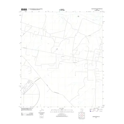
2012 Map of Ligon Ranch
USGS Topo · Published 2012About this map
Ligon Ranch and its surrounding rangelands in Pecos County define this West Texas landscape, where the Pecos River carves a path through the northern section of the territory. The map illustrates a region transitioning between traditional cattle ranching and modern industrial utility, marked by the presence of the West Waha Oil Field and the distinctive looping structures along BF Goodrich Testing Track Rd.
Find a feature on this map
11 named features on this map. Tap any name to fly to it.
Don’t see what you’re looking for? This feature index may not catch every label — zoom into the map to look around manually.
Map Details
Editions of this 2012 Ligon Ranch Map
This is the sole edition of this map. No revisions or reprints were ever made.
Other maps of this area

1931 · Barstow
USGS Topo · 1:125,000

1954 · Pecos
USGS Topo · 1:250,000

1957 · Pecos
USGS Topo · 1:250,000

1963 · Ligon Ranch
USGS Topo · 1:24,000

1963 · Old X Ranch
USGS Topo · 1:24,000

1963 · Quito Draw
USGS Topo · 1:24,000

1963 · China Lake NE
USGS Topo · 1:24,000

1963 · Rio Pecos Ranch
USGS Topo · 1:24,000

1963 · China Lake
USGS Topo · 1:24,000

1970 · Barstow 3 NE
USGS Topo · 1:24,000