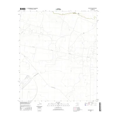
2016 Map of Ligon Ranch
USGS Topo · Published 2016About this map
The Pecos River forms a jagged natural boundary along the northern edge of this West Texas landscape, where the Ward and Reeves county lines meet. Dominated by the arid expanses of the Trans-Pecos, the area is defined by a network of ranch roads and specialized industrial infrastructure. The namesake Ligon Ranch sits in the northeast, while the southwestern corner is marked by the distinct geometry of the Bf Goodrich Testing Track Rd, a specialized facility for automotive evaluation. Cross-country travel is facilitated by Farm Rd 1450, which cuts a straight line through the basin. Local water drainage patterns are evidenced by Blake Draw, a seasonal drainage that feeds toward the river, illustrating the sparse but vital hydraulic network in this part of Pecos County.
Find a feature on this map
10 named features on this map. Tap any name to fly to it.
Don’t see what you’re looking for? This feature index may not catch every label — zoom into the map to look around manually.
Map Details
Editions of this 2016 Ligon Ranch Map
This is the sole edition of this map. No revisions or reprints were ever made.
Other maps of this area

1931 · Barstow
USGS Topo · 1:125,000

1954 · Pecos
USGS Topo · 1:250,000

1957 · Pecos
USGS Topo · 1:250,000

1963 · Ligon Ranch
USGS Topo · 1:24,000

1963 · Old X Ranch
USGS Topo · 1:24,000

1963 · Quito Draw
USGS Topo · 1:24,000

1963 · China Lake NE
USGS Topo · 1:24,000

1963 · Rio Pecos Ranch
USGS Topo · 1:24,000

1963 · China Lake
USGS Topo · 1:24,000

1970 · Barstow 3 NE
USGS Topo · 1:24,000