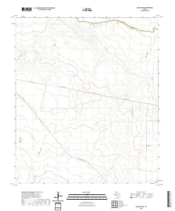
2022 Map of Ligon Ranch
USGS Topo · Published 2022About this map
The Pecos River serves as a natural boundary in this arid landscape of West Texas, separating Reeves County and Ward County. This area is characterized by drainage systems like Blake Draw and Hackberry Draw, which flow toward the river valley. The map documents a sparsely populated ranching landscape where historical family ties are still visible at the Boyd Family Cem, located on the eastern edge of the quadrangle. Transportation through this desert terrain relies on a network of rural routes, including Farm Rd 1450 and Holcomb Rape Ranch Rd. These roads connect isolated ranching outposts and provide access across the wide, open spaces of the Trans-Pecos region. The presence of smaller tracks like Co Rd 103 and Co Rd 104 suggests the continued importance of land access for local property owners in this corner of the state.
Find a feature on this map
9 named features on this map. Tap any name to fly to it.
Don’t see what you’re looking for? This feature index may not catch every label — zoom into the map to look around manually.
Map Details
Editions of this 2022 Ligon Ranch Map
This is the sole edition of this map. No revisions or reprints were ever made.
Other maps of this area

1931 · Barstow
USGS Topo · 1:125,000

1954 · Pecos
USGS Topo · 1:250,000

1957 · Pecos
USGS Topo · 1:250,000

1963 · Ligon Ranch
USGS Topo · 1:24,000

1963 · Old X Ranch
USGS Topo · 1:24,000

1963 · Quito Draw
USGS Topo · 1:24,000

1963 · China Lake NE
USGS Topo · 1:24,000

1963 · Rio Pecos Ranch
USGS Topo · 1:24,000

1963 · China Lake
USGS Topo · 1:24,000

1970 · Barstow 3 NE
USGS Topo · 1:24,000