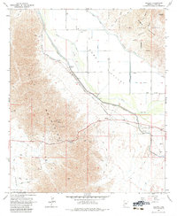
1965 Map of Ligurta
USGS Topo · Published 1984About this map
The Butterfield Stage Route traces a path through this desert landscape, following the southern edge of the Dome Valley where the Southern Pacific railroad also runs. The small settlement of Ligurta sits at the intersection of these transport corridors, anchored by the Gila River to the north. This 1960s survey illustrates a region defined by complex water management, featuring the Wellton Mohawk Canal, Dome Canal, and various siphons and flumes that support agriculture in the arid valley floor.
Find a feature on this map
41 named features on this map. Tap any name to fly to it.
Don’t see what you’re looking for? This feature index may not catch every label — zoom into the map to look around manually.
Map Details
Editions of this 1965 Ligurta Map
3 editions found
Other maps of this area

1926 · Fortuna
USGS Topo · 1:62,500

1926 · Wellton
USGS Topo · 1:62,500

1929 · Fortuna
USGS Topo · 1:62,500

1929 · Laguna
USGS Topo · 1:62,500

1929 · Wellton
USGS Topo · 1:62,500

1942 · Yuma
USGS Topo · 1:250,000

1943 · Laguna
USGS Topo · 1:62,500

1954 · El Centro
USGS Topo · 1:250,000

1955 · El Centro
USGS Topo · 1:250,000
1955 · Dome
USGS Topo · 1:24,000