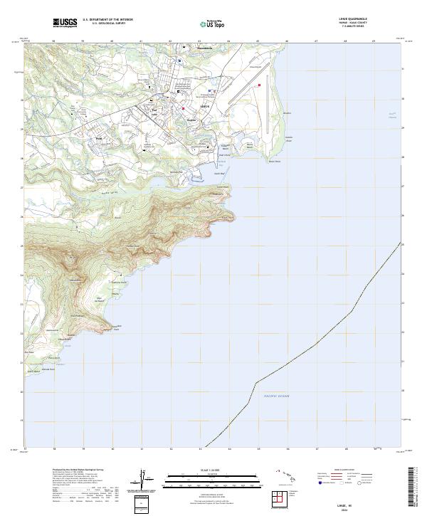
2024 Map of Lihue
USGS Topo · Published 2024About this map
Lihu'e serves as the focal point of this Kauai coastline, where residential expansion meets the historical agricultural legacy of the island. The landscape is defined by the steep transition from the heights of Hokulei Peak and Ha'upu down to the sea, carved by the Nawiliwili Stream and Hula'ia Stream. Genealogical interests are well-served by the presence of several burial grounds, including the Lihue Public Cem, Puhi Camp Cem, and the Halehaka Japanese Cem.
Find a feature on this map
97 named features on this map. Tap any name to fly to it.
Don’t see what you’re looking for? This feature index may not catch every label — zoom into the map to look around manually.
Map Details
Editions of this 2024 Lihue Map
This is the sole edition of this map. No revisions or reprints were ever made.
Other maps of this area

1954 · Kauai
USGS Topo · 1:250,000

1963 · Lihue
USGS Topo · 1:24,000

1963 · Kapaa
USGS Topo · 1:24,000

1963 · Koloa
USGS Topo · 1:24,000

1965 · Waialeale
USGS Topo · 1:24,000

1967 · Kauai
USGS Topo · 1:250,000

1970 · Kauai
USGS Topo · 1:250,000

1978 · Kapaa
USGS Topo · 1:24,000
1978 · Lihue
USGS Topo · 1:24,000
1978 · Koloa
USGS Topo · 1:24,000