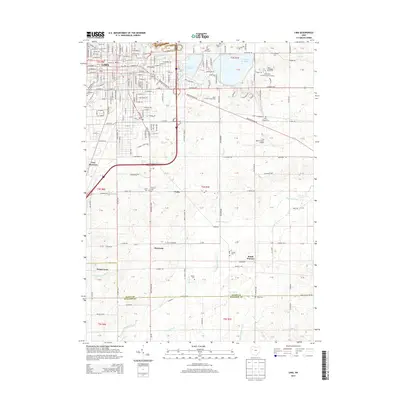
2013 Map of Lima
USGS Topo · Published 2013About this map
The city of Lima serves as the industrial and educational anchor of this Northwest Ohio region, featuring extensive infrastructure from Lima Stadium to the Ohio State University-Lima Campus. The landscape is defined by its water management systems, including the massive Metzger Reservoir, Ferguson Reservoir, and Lost Cr Reservoir, which dominate the northeast quadrant. These reservoirs sit alongside the Erie Lackawanna rail line, illustrating the intersection of natural resources and transport logistics. South of the main city, the terrain transitions into a patchwork of rural settlements and family landmarks. Historic cemeteries such as Bressler Cem and Perry Chapel Cem are scattered near small communities like Yoder and Rousculp. The southern border follows the line between Allen and Auglaize counties, where the Auglaize River and Wrestle Cr meander through agricultural lands.
Find a feature on this map
82 named features on this map. Tap any name to fly to it.
Don’t see what you’re looking for? This feature index may not catch every label — zoom into the map to look around manually.
Map Details
Editions of this 2013 Lima Map
This is the sole edition of this map. No revisions or reprints were ever made.
Other maps of this area

1906 · Lima
USGS Topo · 1:62,500

1906 · Columbus Grove
USGS Topo · 1:62,500

1907 · Bluffton
USGS Topo · 1:62,500

1908 · Columbus Grove
USGS Topo · 1:62,500

1913 · Alger
USGS Topo · 1:48,000

1915 · Alger
USGS Topo · 1:62,500

1943 · Alger
USGS Topo · 1:62,500

1950 · Marion
USGS Topo · 1:250,000

1953 · Muncie
USGS Topo · 1:250,000

1956 · Muncie
USGS Topo · 1:250,000