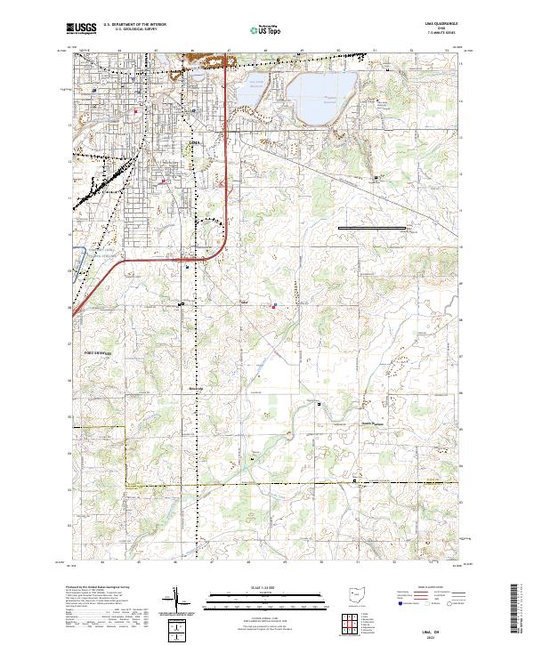
2023 Map of Lima
USGS Topo · Published 2023About this map
Lima and its southern neighboring communities of Fort Shawnee, Yoder, and South Warsaw appear as a complex blend of urban development and rural township infrastructure. The landscape is defined by the heavy presence of logistics and education, with the Lima Allen County Airport and the shared grounds of Ohio State University - Lima Campus and Rhodes State College anchoring the eastern side of the I-75 corridor. Water management for the city is evident through the large Ferguson Reservoir, Lost Creek Reservoir, and Twin Lake Reservoir near the northern border.
Find a feature on this map
39 named features on this map. Tap any name to fly to it.
Don’t see what you’re looking for? This feature index may not catch every label — zoom into the map to look around manually.
Map Details
Editions of this 2023 Lima Map
This is the sole edition of this map. No revisions or reprints were ever made.
Other maps of this area

1906 · Lima
USGS Topo · 1:62,500

1906 · Columbus Grove
USGS Topo · 1:62,500

1907 · Bluffton
USGS Topo · 1:62,500

1908 · Columbus Grove
USGS Topo · 1:62,500

1913 · Alger
USGS Topo · 1:48,000

1915 · Alger
USGS Topo · 1:62,500

1943 · Alger
USGS Topo · 1:62,500

1950 · Marion
USGS Topo · 1:250,000

1953 · Muncie
USGS Topo · 1:250,000

1956 · Muncie
USGS Topo · 1:250,000