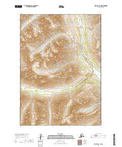
2019 Map of Lime Hills A-1 NE
USGS Topo · Published 2019About this map
Lake Clark National Park encompasses the majority of this remote Kenai Peninsula landscape, where high-elevation terrain is defined by dramatic glacial features and the drainage systems of the Igitna River and Another River. A particularly distinctive landmark, The Tusk, rises in the southwest, serving as a prominent navigational marker for this mountainous interior. The map reflects a modern topographic view from the early twenty-first century, showing a region devoid of roads or settlements. Instead, the focus is on the intricate hydrologic patterns and the shifting ice and rock of the high Alaskian wilderness. The cartography emphasizes the natural boundaries and land management within the park, providing a precise look at the drainage patterns where the Another River cuts through the southern reaches of the quadrangle.
Find a feature on this map
8 named features on this map. Tap any name to fly to it.
Don’t see what you’re looking for? This feature index may not catch every label — zoom into the map to look around manually.
Map Details
Editions of this 2019 Lime Hills A-1 NE Map
This is the sole edition of this map. No revisions or reprints were ever made.
Other maps of this area

1949 · Tyonek
USGS Topo · 1:250,000

1951 · Tyonek
USGS Topo · 1:250,000

1951 · Lime Hills
USGS Topo · 1:250,000

1958 · Tyonek B-8
USGS Topo · 1:63,360

1958 · Tyonek
USGS Topo · 1:250,000

1958 · Tyonek A-8
USGS Topo · 1:63,360

1958 · Lime Hills B-1
USGS Topo · 1:63,360
1958 · Lime Hills A-1
USGS Topo · 1:63,360

1958 · Lime Hills
USGS Topo · 1:250,000

1965 · Tyonek
USGS Topo · 1:250,000