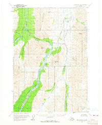
1958 Map of Lime Hills D-1
USGS Topo · Published 1965About this map
The South Fork Kuskokwim River dominates this interior Alaska landscape as it carves through the Teocalli Mountains. The river's path is constrained by significant terrain, most notably at Hellsgate, where the water narrows between steep elevations. The survey captures a truly remote wilderness where the only evidence of human activity is a single Cabin located near the mouth of Hartman stream. To the east, the Styx River flows through a broad Valley, paralleled by the elevations of Mount Rich and Twin Sisters Peak. The map illustrates a network of glacial and mountain runoff, with high-altitude water bodies like Flahart Lake and Styr Lake feeding into the Ptarmigan Creek and Johnson Creek systems. This topography reflects the unsurveyed and unmarked nature of the territory at the time, with land lines predetermined by the Bureau of Land Management.
Find a feature on this map
15 named features on this map. Tap any name to fly to it.
Don’t see what you’re looking for? This feature index may not catch every label — zoom into the map to look around manually.
Map Details
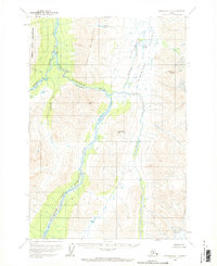
Editions of this 1958 Lime Hills D-1 Map
2 editions found
Other maps of this area

1949 · Tyonek
USGS Topo · 1:250,000

1949 · McGrath
USGS Topo · 1:250,000

1950 · McGrath
USGS Topo · 1:250,000

1950 · Talkeetna
USGS Topo · 1:250,000

1951 · Talkeetna
USGS Topo · 1:250,000

1951 · Tyonek
USGS Topo · 1:250,000

1951 · Lime Hills
USGS Topo · 1:250,000

1958 · Talkeetna A-6
USGS Topo · 1:63,360

1958 · Tyonek C-8
USGS Topo · 1:63,360

1958 · McGrath A-1
USGS Topo · 1:63,360