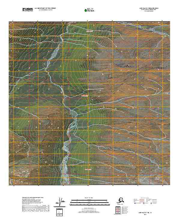
2019 Map of Lime Hills D-1 SE
USGS Topo · Published 2019About this map
The Styx River flows through this remote interior landscape within the Bethel Census Area of Alaska. This 2019 survey documents a wilderness environment defined primarily by its hydrological patterns and the Public Land Survey System grid. The river follows a winding north-south course through the central portion of the map, flanked by several townships including T20n R21w and T19n R21w. In the northeastern corner, Timber Creek provides a secondary drainage point. The map is notably devoid of human infrastructure, roads, or named settlements, reflecting the untrammeled nature of this subarctic terrain. It serves as a precise record of the natural topography and watercourses before any modern development, anchored by the survey lines of the T21n R21w and surrounding blocks.
Find a feature on this map
8 named features on this map. Tap any name to fly to it.
Don’t see what you’re looking for? This feature index may not catch every label — zoom into the map to look around manually.
Map Details
Editions of this 2019 Lime Hills D-1 SE Map
This is the sole edition of this map. No revisions or reprints were ever made.
Other maps of this area

1949 · Tyonek
USGS Topo · 1:250,000

1951 · Tyonek
USGS Topo · 1:250,000

1951 · Lime Hills
USGS Topo · 1:250,000

1958 · Tyonek C-8
USGS Topo · 1:63,360

1958 · Tyonek D-8
USGS Topo · 1:63,360

1958 · Tyonek
USGS Topo · 1:250,000
1958 · Lime Hills D-1
USGS Topo · 1:63,360

1958 · Lime Hills C-1
USGS Topo · 1:63,360

1958 · Lime Hills
USGS Topo · 1:250,000

1965 · Tyonek
USGS Topo · 1:250,000