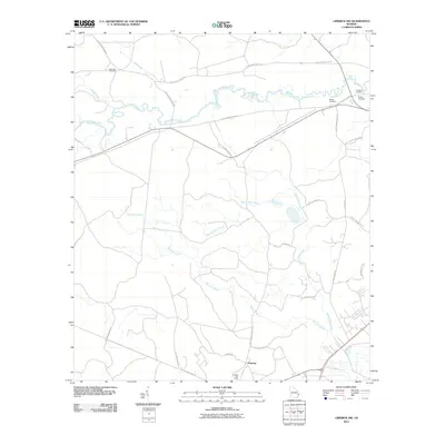
2011 Map of Limerick NW
USGS Topo · Published 2011About this map
Fleming anchors this coastal Georgia landscape, serving as a primary point of settlement along the southern edge of the quadrangle. The area is defined by the winding course of the Canoochee River to the north and a network of named waterways including Mount Hope Creek and Raccoon Branch that drain the surrounding lowlands. To the north, large tracts of land are organized by military infrastructure, evidenced by numerous numbered routes such as Fort Stewart Road 59 and Fort Stewart Road 58. Genealogical interest is concentrated in several family and community burial grounds, including Green Bay Cemetery and Briggs Cemetery near the river, as well as Driggers Cemetery and Bragg Cemetery further east. The map captures the quiet character of Liberty County, where small-scale residential developments like Proman Ln and Cherry Ln sit between agricultural roads and wetlands.
Find a feature on this map
29 named features on this map. Tap any name to fly to it.
Don’t see what you’re looking for? This feature index may not catch every label — zoom into the map to look around manually.
Map Details
Editions of this 2011 Limerick NW Map
This is the sole edition of this map. No revisions or reprints were ever made.
Other maps of this area

1918 · Hinesville
USGS Topo · 1:62,500

1920 · Pembroke
USGS Topo · 1:62,500

1920 · Meldrim
USGS Topo · 1:62,500

1920 · Limerick
USGS Topo · 1:62,500

1942 · Meldrim
USGS Topo · 1:62,500

1944 · Hinesville
USGS Topo · 1:62,500

1944 · Limerick
USGS Topo · 1:62,500

1946 · Brunswick
USGS Topo · 1:250,000

1947 · Savannah
USGS Topo · 1:250,000

1948 · Brunswick
USGS Topo · 1:250,000