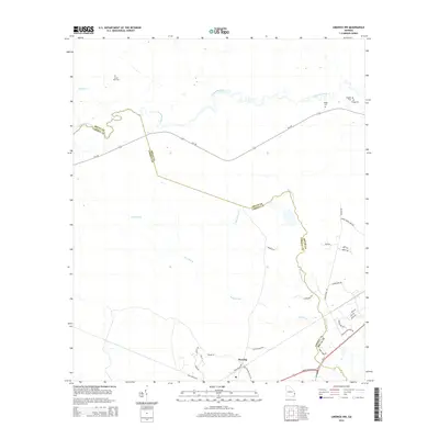
2014 Map of Limerick NW
USGS Topo · Published 2014About this map
The Canoochee River meanders across the upper reaches of this map, defining much of the boundary between Bryan and Liberty Counties. In the southern portion of the sheet, the settlement of Fleming serves as a local hub, situated at the junction of several rural routes and the LeRoy Coffer Hwy. The landscape is dominated by low-lying drainages, including Raccoon Br, Savage Cr, and Mount Hope Cr, which carve through the coastal plain. Family and community heritage is well-preserved through numerous small burial sites such as Briggs Cem, Driggers Cem, and Bragg Cem. The lower-right corner shows a transition toward newer residential developments, evidenced by named lanes like Bailey Plantation Dr and Woodland Way, while the central portion remains characterized by larger undeveloped tracts and winding creeks.
Find a feature on this map
36 named features on this map. Tap any name to fly to it.
Don’t see what you’re looking for? This feature index may not catch every label — zoom into the map to look around manually.
Map Details
Editions of this 2014 Limerick NW Map
This is the sole edition of this map. No revisions or reprints were ever made.
Other maps of this area

1918 · Hinesville
USGS Topo · 1:62,500

1920 · Pembroke
USGS Topo · 1:62,500

1920 · Meldrim
USGS Topo · 1:62,500

1920 · Limerick
USGS Topo · 1:62,500

1942 · Meldrim
USGS Topo · 1:62,500

1944 · Hinesville
USGS Topo · 1:62,500

1944 · Limerick
USGS Topo · 1:62,500

1946 · Brunswick
USGS Topo · 1:250,000

1947 · Savannah
USGS Topo · 1:250,000

1948 · Brunswick
USGS Topo · 1:250,000