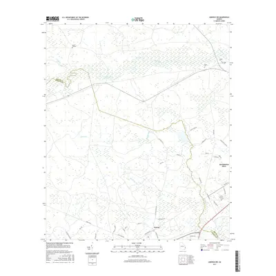
2017 Map of Limerick NW
USGS Topo · Published 2017About this map
The settlement of Fleming and the northwestern edge of Richmond Hill anchor this coastal Georgia survey, which documents the wetlands and drainage basins of the Canoochee River. The landscape is defined by its low-lying hydrology, including Savage Cr, Raccoon Br, and Mount Hope Cr. Genealogists will find several rural burial sites, such as Green Bay Cemetery and Bragg Cemetery, scattered among the drainages. The road network reflects both modern residential growth and older rural corridors, with names like Saddle Swamp Road and Dodge Tram suggesting historical land use patterns. This 2017 edition provides a clear view of the shifting boundary between Bryan and Liberty counties as it follows the meandering course of the river and local tributaries.
Find a feature on this map
45 named features on this map. Tap any name to fly to it.
Don’t see what you’re looking for? This feature index may not catch every label — zoom into the map to look around manually.
Map Details
Editions of this 2017 Limerick NW Map
This is the sole edition of this map. No revisions or reprints were ever made.
Other maps of this area

1918 · Hinesville
USGS Topo · 1:62,500

1920 · Pembroke
USGS Topo · 1:62,500

1920 · Meldrim
USGS Topo · 1:62,500

1920 · Limerick
USGS Topo · 1:62,500

1942 · Meldrim
USGS Topo · 1:62,500

1944 · Hinesville
USGS Topo · 1:62,500

1944 · Limerick
USGS Topo · 1:62,500

1946 · Brunswick
USGS Topo · 1:250,000

1947 · Savannah
USGS Topo · 1:250,000

1948 · Brunswick
USGS Topo · 1:250,000