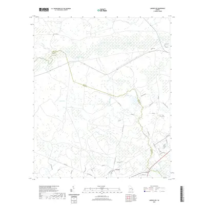
2020 Map of Limerick NW
USGS Topo · Published 2020About this map
Fleming serves as a central hub in this coastal Georgia landscape, where the low-lying terrain is defined by the winding course of the Canoochee River and its numerous tributaries. The map documents a complex network of waterways, including Mount Hope Cr, Raccoon Br, and Savage Cr, which historically dictated the pattern of local settlement and transport. Evidence of long-standing community ties is visible in the cluster of family and local burial sites such as Green Bay Cem, Briggs Cem, Driggers Cem, and Bragg Cem. The presence of Dodge Tram in the southern portion suggests a legacy of industrial activity, likely related to the region's timber or turpentine history. Modern development appears in the southeastern corner near Bailey Plantation Dr, illustrating how newer residential subdivisions have begun to intermingle with the established rural roads and forested wetlands of the Bryan and Liberty County border.
Find a feature on this map
43 named features on this map. Tap any name to fly to it.
Don’t see what you’re looking for? This feature index may not catch every label — zoom into the map to look around manually.
Map Details
Editions of this 2020 Limerick NW Map
This is the sole edition of this map. No revisions or reprints were ever made.
Other maps of this area

1918 · Hinesville
USGS Topo · 1:62,500

1920 · Pembroke
USGS Topo · 1:62,500

1920 · Meldrim
USGS Topo · 1:62,500

1920 · Limerick
USGS Topo · 1:62,500

1942 · Meldrim
USGS Topo · 1:62,500

1944 · Hinesville
USGS Topo · 1:62,500

1944 · Limerick
USGS Topo · 1:62,500

1946 · Brunswick
USGS Topo · 1:250,000

1947 · Savannah
USGS Topo · 1:250,000

1948 · Brunswick
USGS Topo · 1:250,000