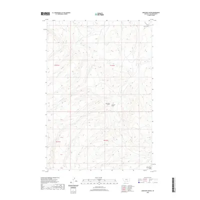
2020 Map of Limestone Canyon
USGS Topo · Published 2020About this map
Limestone Canyon and Soap Creek Canyon dominate this part of Big Horn County, Montana, where the terrain is deeply incised by a network of drainage systems. The landscape is defined by the convergence of several waterways, including W Soap Cr, Soap Cr, and Deer Cr, which carve through the high country. In the northern reaches, Goose Coulee provides a distinctive drainage feature, while Rotten Grass Canyon is visible in the southeastern corner.
Find a feature on this map
14 named features on this map. Tap any name to fly to it.
Don’t see what you’re looking for? This feature index may not catch every label — zoom into the map to look around manually.
Map Details
Editions of this 2020 Limestone Canyon Map
This is the sole edition of this map. No revisions or reprints were ever made.
Other maps of this area

1894 · St. Xavier
USGS Topo · 1:125,000

1901 · St. Xavier
USGS Topo · 1:125,000

1954 · Hardin
USGS Topo · 1:250,000

1957 · Hardin
USGS Topo · 1:250,000

1958 · Hardin
USGS Topo · 1:250,000

1960 · Mission Coulee
USGS Topo · 1:24,000

1964 · Peyote Point
USGS Topo · 1:24,000
1964 · Mountain Pocket Creek
USGS Topo · 1:24,000
1964 · Yellowtail Dam
USGS Topo · 1:24,000
1969 · Willow Creek Dam SW
USGS Topo · 1:24,000