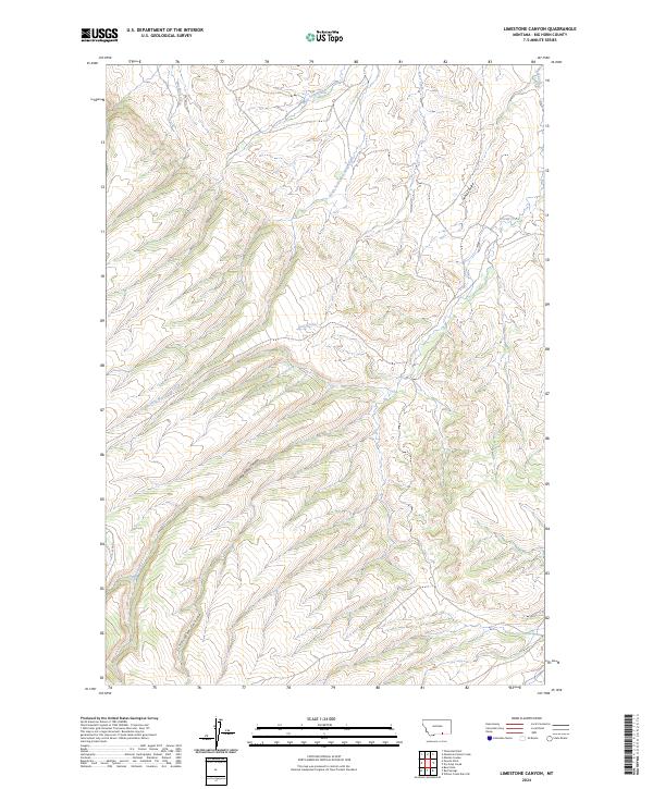
2024 Map of Limestone Canyon
USGS Topo · Published 2024About this map
Limestone Canyon and the surrounding drainage networks of Big Horn County define this section of the Montana landscape. The area is characterized by deep incisions like Soap Creek Canyon, where the terrain drops sharply into narrow corridors shaped by seasonal and perennial water flow. The complex hydrology of the region is evident in the converging tributaries of Soap Creek, including the South Fork West Soap Creek and West Soap Creek.
Find a feature on this map
12 named features on this map. Tap any name to fly to it.
Don’t see what you’re looking for? This feature index may not catch every label — zoom into the map to look around manually.
Map Details
Editions of this 2024 Limestone Canyon Map
This is the sole edition of this map. No revisions or reprints were ever made.
Other maps of this area

1894 · St. Xavier
USGS Topo · 1:125,000

1901 · St. Xavier
USGS Topo · 1:125,000

1954 · Hardin
USGS Topo · 1:250,000

1957 · Hardin
USGS Topo · 1:250,000

1958 · Hardin
USGS Topo · 1:250,000

1960 · Mission Coulee
USGS Topo · 1:24,000

1964 · Peyote Point
USGS Topo · 1:24,000
1964 · Mountain Pocket Creek
USGS Topo · 1:24,000
1964 · Yellowtail Dam
USGS Topo · 1:24,000
1969 · Willow Creek Dam SW
USGS Topo · 1:24,000