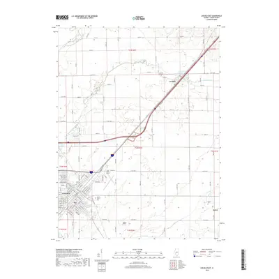
2018 Map of Lincoln East
USGS Topo · Published 2018About this map
The city of Lincoln serves as the focal point of this 2018 survey, showcasing a landscape where academic institutions and aviation infrastructure meet the rural prairie. The southwestern quadrant is defined by the campuses of Lincoln College and Lincoln Christian Univ, while the regional connectivity is anchored by the Logan County Airport and the smaller Minder Airport. This modern record preserves the legacy of historic transportation corridors, most notably the path of Old Rte 66, which runs parallel to the modern interstate through the settlement of Lawndale.
Find a feature on this map
79 named features on this map. Tap any name to fly to it.
Don’t see what you’re looking for? This feature index may not catch every label — zoom into the map to look around manually.
Map Details
Editions of this 2018 Lincoln East Map
This is the sole edition of this map. No revisions or reprints were ever made.
Other maps of this area

1911 · Lincoln
USGS Topo · 1:62,500

1913 · Lincoln
USGS Topo · 1:62,500

1949 · Mc Lean
USGS Topo · 1:62,500

1951 · McLean
USGS Topo · 1:62,500

1951 · Minier
USGS Topo · 1:62,500

1957 · Kenney
USGS Topo · 1:62,500

1958 · Peoria
USGS Topo · 1:250,000

1961 · Peoria
USGS Topo · 1:250,000

1963 · Peoria
USGS Topo · 1:250,000

1980 · Armington
USGS Topo · 1:24,000