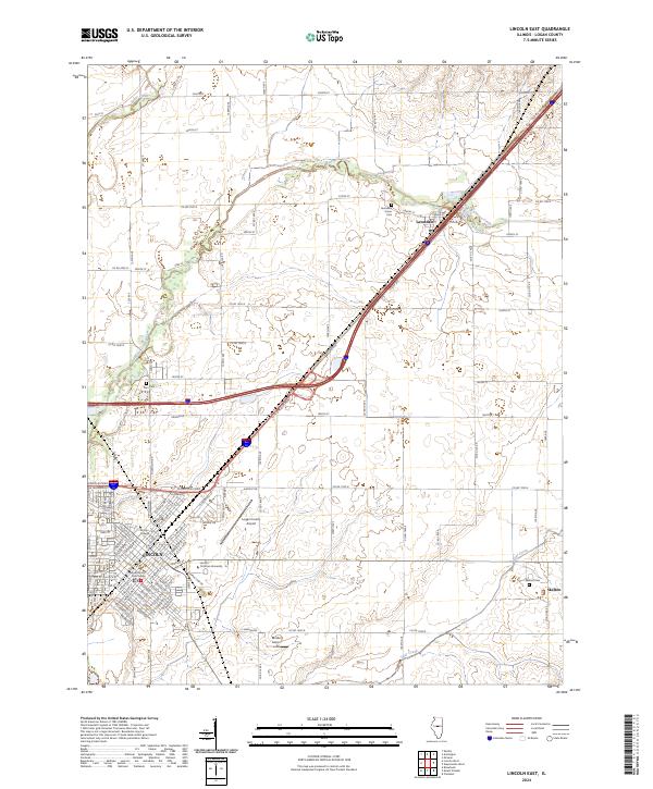
2024 Map of Lincoln East
USGS Topo · Published 2024About this map
Lincoln stands as the central hub of this Logan County landscape, where the Logan County Courthouse serves as a geographic and civic anchor. The city is characterized by its educational institutions, notably Lincoln College and Lincoln Christian University, which have long shaped the local community. To the northeast, the settlement of Lawndale sits along a major transportation corridor, while the smaller locale of Skelton marks the eastern reaches. The drainage patterns of Kickapoo Creek, Sugar Creek, and Deer Creek weave through the agricultural surroundings, defining the natural layout of the region.
Find a feature on this map
42 named features on this map. Tap any name to fly to it.
Don’t see what you’re looking for? This feature index may not catch every label — zoom into the map to look around manually.
Map Details
Editions of this 2024 Lincoln East Map
This is the sole edition of this map. No revisions or reprints were ever made.
Other maps of this area

1911 · Lincoln
USGS Topo · 1:62,500

1913 · Lincoln
USGS Topo · 1:62,500

1949 · Mc Lean
USGS Topo · 1:62,500

1951 · McLean
USGS Topo · 1:62,500

1951 · Minier
USGS Topo · 1:62,500

1957 · Kenney
USGS Topo · 1:62,500

1958 · Peoria
USGS Topo · 1:250,000

1961 · Peoria
USGS Topo · 1:250,000

1963 · Peoria
USGS Topo · 1:250,000

1980 · Armington
USGS Topo · 1:24,000