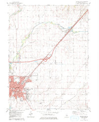
1980 Map of Lincoln East
USGS Topo · Published 1980About this map
Lincoln serves as the focal point of this Central Illinois landscape, where the urban street grid of the county seat meets the expansive agricultural reaches of East Lincoln and Eminence townships. The map documents a mature mid-century community characterized by a concentration of educational institutions, including Lincoln College, Lincoln Christian College, and the Abe Lincoln Sch. Cultural and social landmarks like the Drive-in Theater and Recreation Center sit alongside vital local infrastructure such as the Logan Co Airport and the Gaging Station on Kickapoo Creek.
Find a feature on this map
48 named features on this map. Tap any name to fly to it.
Don’t see what you’re looking for? This feature index may not catch every label — zoom into the map to look around manually.
Map Details
Editions of this 1980 Lincoln East Map
This is the sole edition of this map. No revisions or reprints were ever made.
Other maps of this area

1911 · Lincoln
USGS Topo · 1:62,500

1913 · Lincoln
USGS Topo · 1:62,500

1949 · Mc Lean
USGS Topo · 1:62,500

1951 · McLean
USGS Topo · 1:62,500

1951 · Minier
USGS Topo · 1:62,500

1957 · Kenney
USGS Topo · 1:62,500

1958 · Peoria
USGS Topo · 1:250,000

1961 · Peoria
USGS Topo · 1:250,000

1963 · Peoria
USGS Topo · 1:250,000

1980 · Armington
USGS Topo · 1:24,000