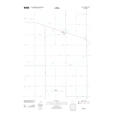
2013 Map of Lincoln
USGS Topo · Published 2013About this map
The settlement of Lincoln anchors the southern portion of this Tama County landscape, situated near the headwaters of Fourmile Cr. To the north, the town of Morrison sits along the winding course of Black Hawk Cr, a primary drainage that cuts diagonally across the northern tier. This 2013 survey illustrates the disciplined grid of the Iowa countryside, where section-line roads like 250th St and R Ave define the agricultural layout. Several smaller tributaries, including Munns Cr and Mosquito Cr, weave through the terrain, suggesting a complex watershed that drains toward the E Tama boundary. The map captures a moment of modern rural stability, documenting the precise intersections and farmstead locations that have shaped the local identity of these small communities.
Find a feature on this map
40 named features on this map. Tap any name to fly to it.
Don’t see what you’re looking for? This feature index may not catch every label — zoom into the map to look around manually.
Map Details
Editions of this 2013 Lincoln Map
This is the sole edition of this map. No revisions or reprints were ever made.
Other maps of this area

1954 · Waterloo
USGS Topo · 1:250,000

1955 · Waterloo
USGS Topo · 1:250,000

1960 · Marshalltown
USGS Topo · 1:62,500

1960 · Conrad East
USGS Topo · 1:24,000

1971 · Gladbrook NE
USGS Topo · 1:24,000

1971 · Zaneta
USGS Topo · 1:24,000

1971 · Dike
USGS Topo · 1:24,000

1971 · Lincoln
USGS Topo · 1:24,000

1971 · Reinbeck
USGS Topo · 1:24,000
1971 · Gladbrook
USGS Topo · 1:24,000