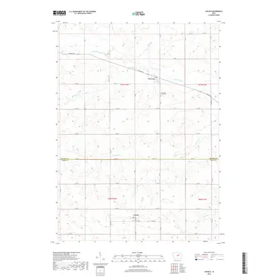
2018 Map of Lincoln
USGS Topo · Published 2018About this map
Lincoln and Morrison anchor this agricultural landscape along the border of Grundy and Tama Counties. The terrain is defined by a dense network of watercourses, including the winding Black Hawk Creek in the north and several numbered streams such as Fourmile Creek and Twelvemile Creek to the south. This 2018 survey illustrates a highly organized township structure where modern section lines and established routes like Diagonal Road and Tama Road cut across the natural drainage patterns of Mosquito Creek and Munns Creek. Local heritage is centered around small-town hubs and the Washington Township Cemetery, reflecting a community deeply tied to the surrounding prairie soil and the enduring grid of rural Iowa.
Find a feature on this map
26 named features on this map. Tap any name to fly to it.
Don’t see what you’re looking for? This feature index may not catch every label — zoom into the map to look around manually.
Map Details
Editions of this 2018 Lincoln Map
This is the sole edition of this map. No revisions or reprints were ever made.
Other maps of this area

1954 · Waterloo
USGS Topo · 1:250,000

1955 · Waterloo
USGS Topo · 1:250,000

1960 · Marshalltown
USGS Topo · 1:62,500

1960 · Conrad East
USGS Topo · 1:24,000

1971 · Gladbrook NE
USGS Topo · 1:24,000

1971 · Zaneta
USGS Topo · 1:24,000

1971 · Dike
USGS Topo · 1:24,000

1971 · Lincoln
USGS Topo · 1:24,000

1971 · Reinbeck
USGS Topo · 1:24,000
1971 · Gladbrook
USGS Topo · 1:24,000