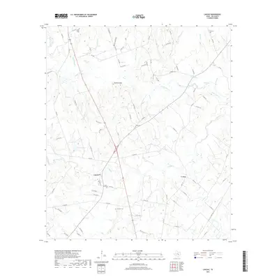
2019 Map of Lincoln
USGS Topo · Published 2019About this map
The community of Lincoln anchors this Lee County landscape, situated at a crossroad of local routes and the upper reaches of Elm Cr. The terrain is defined by the winding paths of the Middle Yegua Cr and W Yegua Cr, which drain the low-lying areas between distinctive rises like Buzzard Knobs. This 2019 survey documents a rural environment where land use is closely tied to the hydrology of features such as Doak Springs and Molty Smith Lake. For genealogists and local historians, the map is a primary record of the area's social geography, preserving the locations of numerous family and community burial grounds including Saint Peters Cem, Evergreen Cem, and New Bethel Cem. The settlement pattern extends to small locales like Loebau and Leo, connected by an intricate network of county and private roads that trace the historic boundaries of central Texas ranch and farm land.
Find a feature on this map
88 named features on this map. Tap any name to fly to it.
Don’t see what you’re looking for? This feature index may not catch every label — zoom into the map to look around manually.
Map Details
Editions of this 2019 Lincoln Map
This is the sole edition of this map. No revisions or reprints were ever made.
Other maps of this area

1885 · Bastrop
USGS Topo · 1:125,000

1893 · Bastrop
USGS Topo · 1:125,000

1904 · Bastrop
USGS Topo · 1:125,000

1919 · Giddings
USGS Topo · 1:62,500

1919 · Dime Box
USGS Topo · 1:62,500

1948 · Smithville
USGS Topo · 1:62,500

1948 · Lexington
USGS Topo · 1:62,500

1950 · Lexington
USGS Topo · 1:62,500

1950 · Smithville
USGS Topo · 1:62,500

1954 · Austin
USGS Topo · 1:250,000