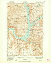
1950 Map of Lincoln
USGS Topo · Published 1950About this map
The confluence of the (Columbia River) and the (Spokane River) dominates this post-war landscape, reshaped by the rising waters of Franklin D Roosevelt Lake. This survey captures the region as it adjusted to the newly created reservoir, where traditional crossings and low-lying terrain gave way to the Franklin D Roosevelt Lake National Recreational Area. Inland from the shoreline, established rural nodes like Enterprise and Lincoln remain centers of local life, supported by the Enterprise Sch and Rothlisburg Sch.
Find a feature on this map
54 named features on this map. Tap any name to fly to it.
Don’t see what you’re looking for? This feature index may not catch every label — zoom into the map to look around manually.
Map Details
Editions of this 1950 Lincoln Map
2 editions found
Other maps of this area

1948 · Hunters
USGS Topo · 1:62,500

1948 · Wilbur
USGS Topo · 1:62,500

1948 · Wilmont Creek
USGS Topo · 1:62,500

1948 · Lincoln
USGS Topo · 1:62,500

1948 · Turtle Lake
USGS Topo · 1:62,500

1950 · Lincoln
USGS Topo · 1:62,500

1950 · Turtle Lake
USGS Topo · 1:62,500

1950 · Wilmont Creek
USGS Topo · 1:62,500

1950 · Wilbur
USGS Topo · 1:62,500

1950 · Hunters
USGS Topo · 1:62,500