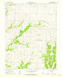
1961 Map of Lincoln NW
USGS Topo · Published 1962About this map
Santiago and Palo Pinto serve as the primary nodes of settlement in this rural Missouri landscape within the White township boundary. The terrain is deeply defined by a dendritic drainage network, with Brush Creek and its many tributaries carving through the topography. This 1961 field-checked survey reveals a quiet, agrarian economy where local social life centered around landmarks like Harmony Ch, Clear Creek Ch, and the Fairfield Sch.
Find a feature on this map
15 named features on this map. Tap any name to fly to it.
Don’t see what you’re looking for? This feature index may not catch every label — zoom into the map to look around manually.
Map Details
Editions of this 1961 Lincoln NW Map
2 editions found
Other maps of this area

1885 · Warrensburg
USGS Topo · 1:125,000

1887 · Clinton
USGS Topo · 1:125,000

1887 · Sedalia
USGS Topo · 1:125,000

1887 · Warsaw
USGS Topo · 1:125,000

1887 · Warrensburg
USGS Topo · 1:125,000

1894 · Warsaw
USGS Topo · 1:125,000

1894 · Sedalia
USGS Topo · 1:125,000

1894 · Warrensburg
USGS Topo · 1:125,000

1894 · Clinton
USGS Topo · 1:125,000

1936 · Shawnee Bend
USGS Topo · 1:24,000