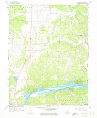
1959 Map of Lincoln SE
USGS Topo · Published 1976About this map
The Osage River and the northern reaches of the Lake of the Ozarks dominate the southern portion of this Benton County landscape, where the rising waters filled deep-cut hollows like Turkey Cr Cove and Townes Hollow. The upland areas to the north are defined by a network of rural institutions that served mid-century farming families, including the Lincoln Lookout Tower and multiple country schools such as Poplar Sch and Dillon Sch.
Find a feature on this map
33 named features on this map. Tap any name to fly to it.
Don’t see what you’re looking for? This feature index may not catch every label — zoom into the map to look around manually.
Map Details
Editions of this 1959 Lincoln SE Map
3 editions found
Other maps of this area

1887 · Warsaw
USGS Topo · 1:125,000

1894 · Warsaw
USGS Topo · 1:125,000

1935 · Edwards
USGS Topo · 1:24,000

1935 · Dell
USGS Topo · 1:24,000

1936 · Shawnee Bend
USGS Topo · 1:24,000

1936 · Lakeview Heights
USGS Topo · 1:24,000

1936 · Schuyler
USGS Topo · 1:24,000

1945 · Fristoe
USGS Topo · 1:62,500

1947 · Jefferson City
USGS Topo · 1:250,000

1954 · Jefferson City
USGS Topo · 1:250,000