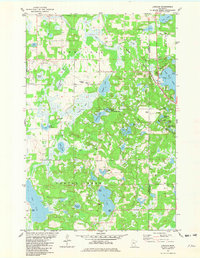
1981 Map of Lincoln
USGS Topo · Published 1982About this map
The glacial landscape of central Minnesota is defined here by an intricate mosaic of kettle lakes and wetlands along the border of Todd and Morrison Counties. The small settlement of Lincoln serves as a local hub near the eastern edge, anchored by the Lincoln Ch and adjacent to the prominent waters of Fish Trap Lake. This area reflects a mid-century balance of recreation and infrastructure, where numerous public access points on lakes like Big Lake and Rice Lake sit alongside industrial features including a prominent Pipeline and the Burlington Northern railroad corridor.
Find a feature on this map
44 named features on this map. Tap any name to fly to it.
Don’t see what you’re looking for? This feature index may not catch every label — zoom into the map to look around manually.
Map Details
Editions of this 1981 Lincoln Map
This is the sole edition of this map. No revisions or reprints were ever made.
Other maps of this area

1948 · Cushing
USGS Topo · 1:62,500

1950 · Cushing
USGS Topo · 1:62,500

1953 · Brainerd
USGS Topo · 1:250,000

1957 · Brainerd
USGS Topo · 1:250,000

1958 · Brainerd
USGS Topo · 1:250,000
1963 · Motley SE
USGS Topo · 1:24,000

1963 · Motley
USGS Topo · 1:24,000

1965 · Brainerd
USGS Topo · 1:250,000
1966 · Browerville
USGS Topo · 1:24,000
1966 · Browerville NE
USGS Topo · 1:24,000